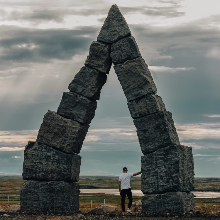
Exploring the wild west of Iceland – lava fields, seals, and our first F-road.
The Snæfellsnes Peninsula is a part of the island that is often overlooked, favoring instead the Westfords further north. It is, however, an incredible area to explore on your ring road journey, or even as a long day trip from Reykjavik.
The most western point of Iceland offers incredible landscapes, as this wild part of the island feels like it’s being constantly torn apart and reborn, with volcanoes spouting from the ground at every turn, lava fields stretching as far as the eye can see, and the Atlantic ocean crashing against its shores.
Although the area may sound harsh and desolate, it’s in fact teeming with life – the black lava fields are covered in lush green moss, and we’ll meet some friendly seals along the southern coast.
Our trip around Snæfellsnes took us to some more typical areas, but we also experienced some surprises along the way, like climbing a dormant volcano and taking our first drive through a steep, foggy F-road through a glacier.
So, here are my top 10 must-see stops on your journey across the Snæfellsnes Peninsula
- Gerðuberg cliffs
- Svörtuloft Lighthouse
- Ytri Tunga Beach
- Rauðfeldsgjá Gorge
- Arnastapi
- Snæfellsjökull National Park
- Búðakirkja, the Black Church
- Snæfellsjökull Glacier
- Selvallafoss
- The Ölkelduvatn Mineral Spring
Now, you may be thinking “hang on James…I don’t see Kirkjufell on this list!”, and rightfully so. If you don’t know, Kirkjufell is the most photographed mountain in Iceland, making it one of the tourist hotspots for the area. So, odds are you’ve probably come across this in your planning already, and if you haven’t, you’re sure to.
The mountain and its waterfall neighbor, Kirkjufellsfoss, are worth stopping at. The sheer size of the mountain and its perfect cone shape make it a unique place worth stopping at, and if you’re a photographer you can capture the iconic shot of the waterfall in the foreground and the mountain in the background.
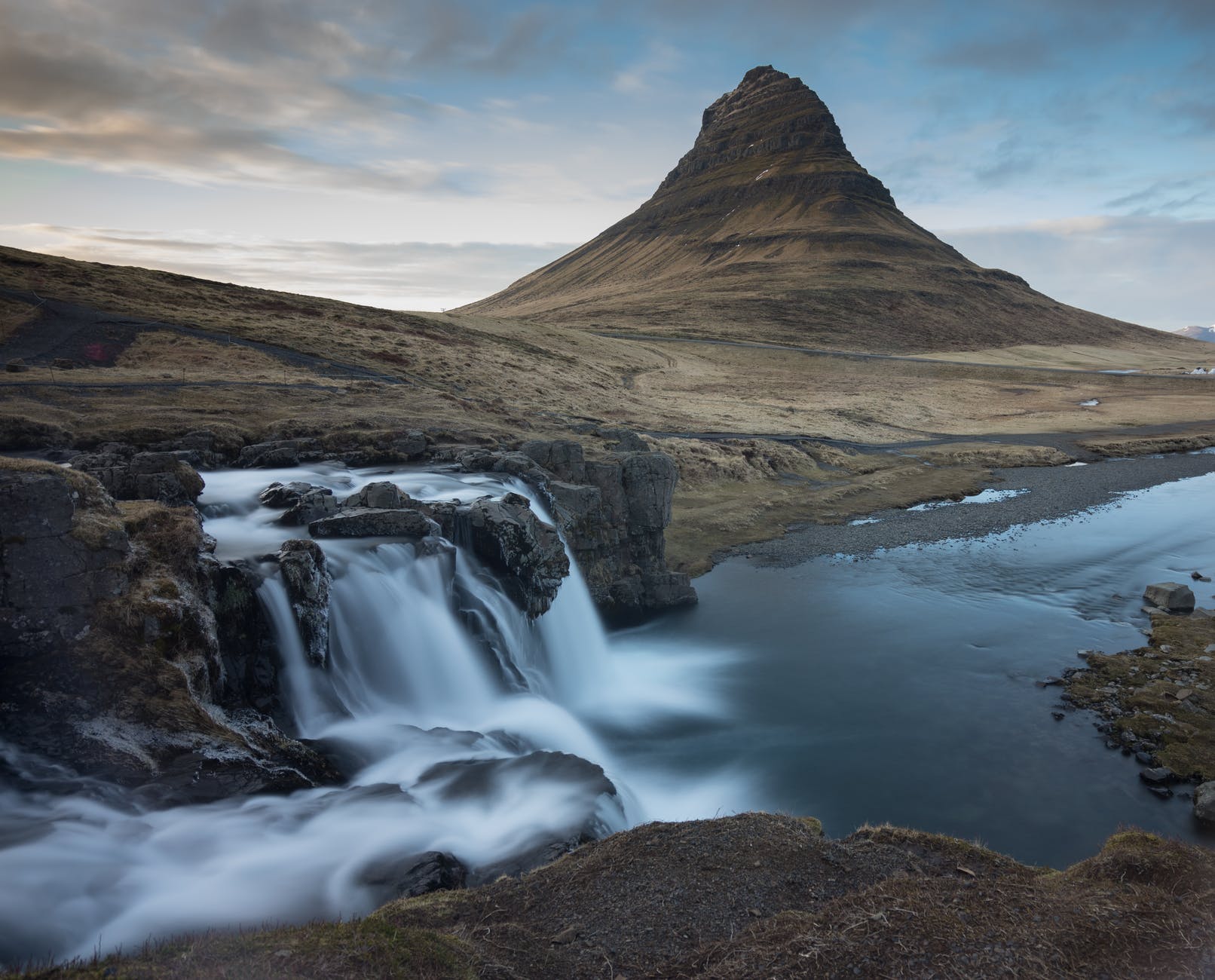
For me, that’ll have to be a stop on my next trip to Iceland, as we favored Selvallafoss instead, a neighboring waterfall with an incredible panoramic view of the sea, lava fields, and extinct volcanoes.
Driving from Reykjavik to the peninsula should take you just over a couple of hours if you follow route 54. Although we did stop a couple of times to take in the view, the real treat comes when you reach the peninsula, starting with the Gerðuberg cliffs.
Gerðuberg cliffs
Have you ever wondered what cooling lava pushing up through the earth in evenly spaced centers and cooled over hundreds of years looks like?
Me neither.
Or at least, I didn’t use to until I came across these intriguing, hexagonal columns reaching up to 15 meters high at Gerðuberg cliffs. These kinds of geological structures aren’t unique to the area, you’ll often see them across the island with some particularly beautiful examples like Svartifoss and Aldeyjarfoss, Studlagil canyon, and along the coastline of Arnarstapi as we’ll see later on.

The volcanic fields
covered in green moss with the
red hills popping out of the earth.
Gerðuberg cliffs
from the ground, basalt columns
reaching up to 15 meters high.

The Perlan Museum in Reykjavik has a very informative (and fun!) exhibit on this which is worth seeing if you want to fully understand some of Iceland’s geological marvels.
You’ll reach the cliffs through a short dirt road off route 54 (the main road that goes around the peninsula) that runs parallel to the cliffside. You should see a church in the distance, at the end of the road, and a narrow road that climbs the mountainside (more on that later).
Once you’ve parked, you’ll see a few footpaths you can climb if you want to stand atop the cliff and see the lava fields, but for me, the real beauty of this area is seeing the columns from their base. Although the cliff isn’t as monumental as the rift in Thingvellir, the unique structure is unlike anything I’d ever seen before and worth seeing on your way to the peninsula.
Now, if you’re feeling adventurous, you should continue along the road in the direction of the church, which takes you up behind the mountain and up onto an extinct volcano.
On your way up, you’ll pass the Ytri-Rauðamelskirkja church on your right as you climb the red slopes of the mountain, and after another 5 to 10 minutes of driving, you’ll find what looks like a parking area at the base of the volcano.
There’s a small path you can follow to reach the summit, but it’s quite a steep and slippery climb so make sure you have walking shoes if you plan on going up. Expect roughly 30 minutes to go up and down them safely.
You’ll be rewarded for your efforts with the fact that you just climbed a volcano and an incredible panoramic view of the lava fields below.

Svörtuloft Lighthouse
This iconic lighthouse on the westernmost point of the peninsula has the interesting characteristic of actually having two names – from the sea it is called Svörtuloftaviti lighthouse, whereas from land it’s called Skálasnagaviti.

Perched on the basalt cliffs that tower over the Atlantic, Svörtuloft is hard to miss with its bright, orange color. As you drive towards the lighthouse, you can easily see it in the distance, even on a foggy day. The route that leads there follows a narrow dirt road that’s quite comfortable to drive.
On your way to Svörtuloft, you’ll pass by Skarðsvík beach which, on a nice day, is worth a stop to take in the fresh Atlantic air. Stay vigilant if you decide to go for a stroll on the beach, as the area is known for its powerful waves. If you can, it’s best to visit at low tide.
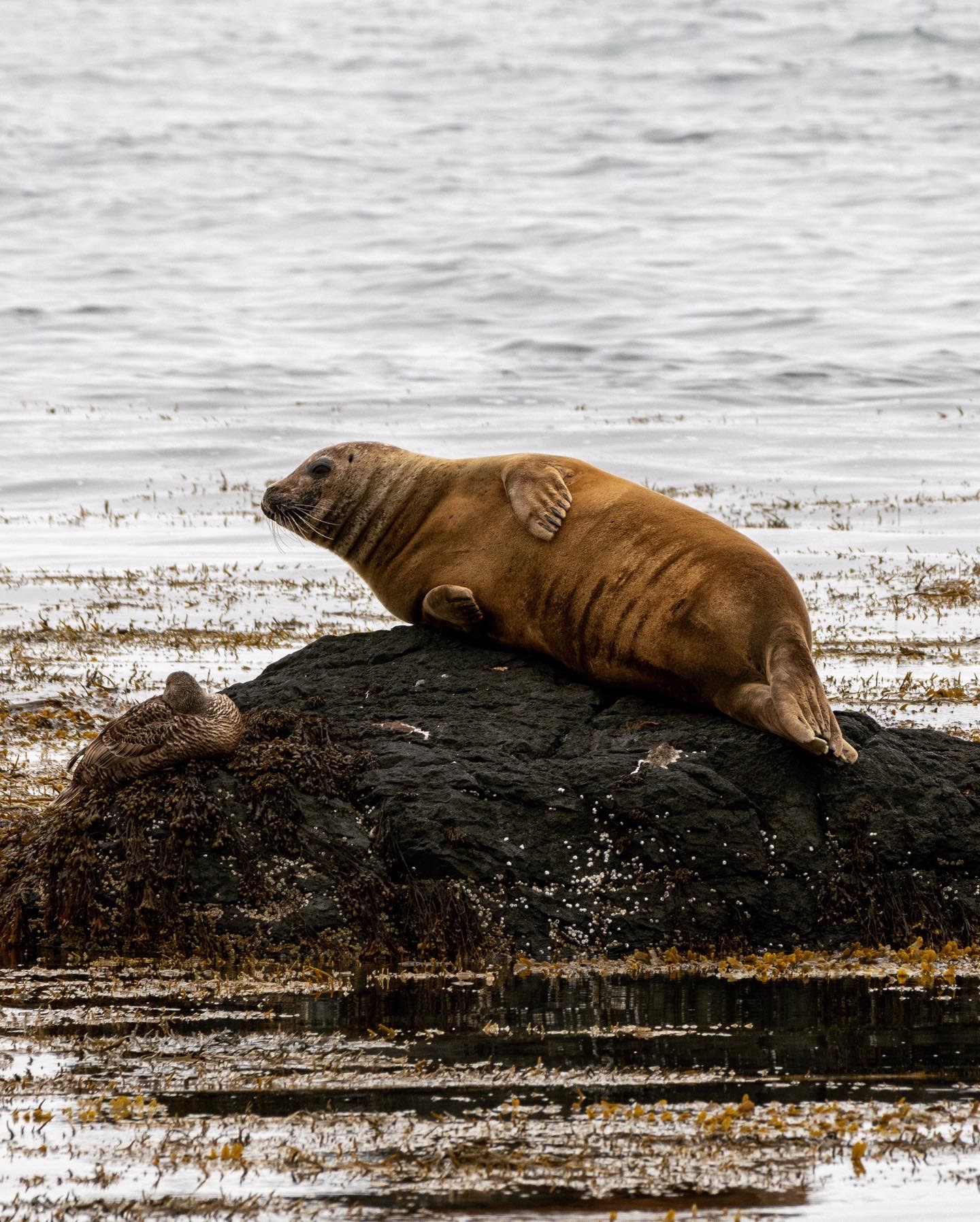
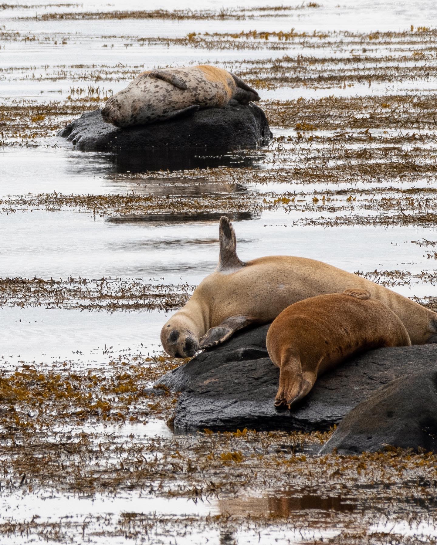
Ytri Tunga Beach
Let’s face it when it comes to wildlife in Iceland, you’re not likely to run into more than sheep and the odd Icelandic horse on your journey unless you’re lucky enough to spot the very elusive arctic fox. And although there’s nothing wrong with marveling at the beauty of the land, Ytri Tunga Beach is an opportunity to get to meet some of its inhabitants.
On this stretch of beach along the southern coast of the peninsula, you can observe harbor seals (or the common seal) and grey seals in their natural habitat, often lazing on the rocks or beaches. It’s incredible to get to see these creatures so close, but remember that we’re guests in their home, so please make sure to respect the rules of conduct outlined on the signage near the parking.
You’re most likely to see our chubby sea friends over the summer months, especially at low tide when they climb onto the rocks.

Rauðfeldsgjá Gorge
This immense gorge on the side of Mount Botnsfjall is a popular spot on a trip around the peninsula during the summer.

Walking from the car park to the entrance to the gorge takes about 10 minutes with a gentle climb. A small stream runs through the gorge so make sure you’re wearing walking shoes and it’s worth bringing some waterproof clothing for comfort.

As you enter the mouth of the gorge, you’ll notice the walls covered in a luscious green moss from the floor along all sides of the grotto, with a window to the sky overhead.
Although you can follow the narrow path upstream through the gorge, I don’t recommend doing so as the path becomes quite narrow and wet.
The gorge gets its name from the saga of Bárður Snæfellsás, whose statue you can see in Arnarstapi, and means Red-Cloak Rift. The first part of the saga follows the half-giant Bárður, who upon his death became the guardian spirit of the Snæfellsnes Peninsula.
The tale goes that Rauðfeldur, Bárður’s nephew, pushed his elder daughter onto an iceberg while playing which is said to have drifted all the way to Greenland. Although his daughter survived, in his fury Bárður cast Rauðfeldur and his brother Sölvi into the gorge as punishment.
Arnarstapi
Speaking of the tale of Bárður, you can marvel at a statue in his honor in the nearby town of Arnarstapi.

The statue of Bárður near Arnarstapi
watches over the peninsula as clouds roll over the mountain.
A lone house near the coast in Arnarstapi
perched on the basalt cliffs.

This small coastal village on the southern part of the peninsula was once a fishing hub due to the natural harbor, allowing settlers to fish the nearby waters rich in herring. Today, it’s a popular stop for tourists before heading to Snæfellsjökull National Park.
Arnarstapi proposes essential services for travelers exploring the peninsula, a wide array of accommodation options, and tour companies.
One of the most interesting features of Arnarstapi’s beaches is the stone arch that has been eroded by the unrelenting sea called Gatklettur.
Although the village itself is very charming and offers an amazing view of the whole coast from a viewing platform situated above the harbor, you’re going to want to take off and discover the nearby Snaefellsjokull National Park.
Snæfellsjökull National Park
This is one of only a handful of national parks in the country, which gives you a good sense of how impressive the area is. There are a number of great walks you can take along the coast and through the lava fields to get up close and personal with the rugged landscape of Snæfellsnes.
Below is a list of some of the most popular walks through the Snaefellsjokull National Park from AllTrails.

We’d initially planned to do the loop between Dritvík and Aflraunasteinar along the Djúpalónssandur black beach, but chose not to in the end due to poor weather conditions. If you’re braver than us, I hear the walk is equally beautiful in the rain, just make sure you’re properly equipped!
Instead, we took a short walk along the coast from Arnarstapi to Hellnar, just make sure you have walking boots as the path gets rocky in certain areas, and make sure you have something waterproof if it’s looking like a damp day.

Búðakirkja the Black Church
Is there anything more poetic than a charcoal-colored church in the middle of a lava field?
Búðakirkja is both beautiful and ominous, sporting a black mantle that gives it a distinctive appearance from the coating of the wood (pitch) which protects it from the harsh Icelandic conditions.
The church was initially built in 1703 but was eventually taken down due to the small number of parishioners. The church as seen today was built in 1987 and is used both for traditional church events for the parish, but also for other events like destination weddings, music events, and storytelling.
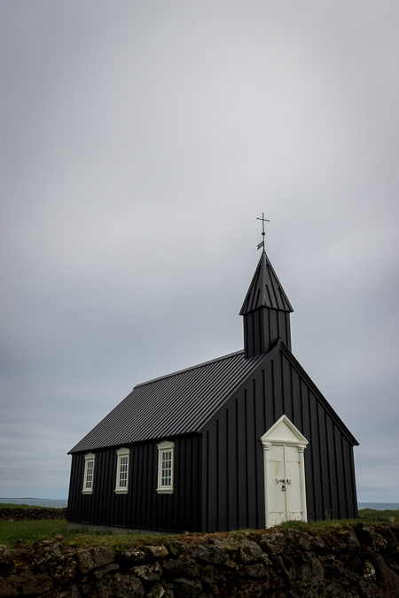
While you’re in the area, you can also visit the beautiful Bjarnarfoss waterfall that’s a short drive from the black church, on route 54. In fact, you can even see the waterfall in the background if you look at the church from its southern side.


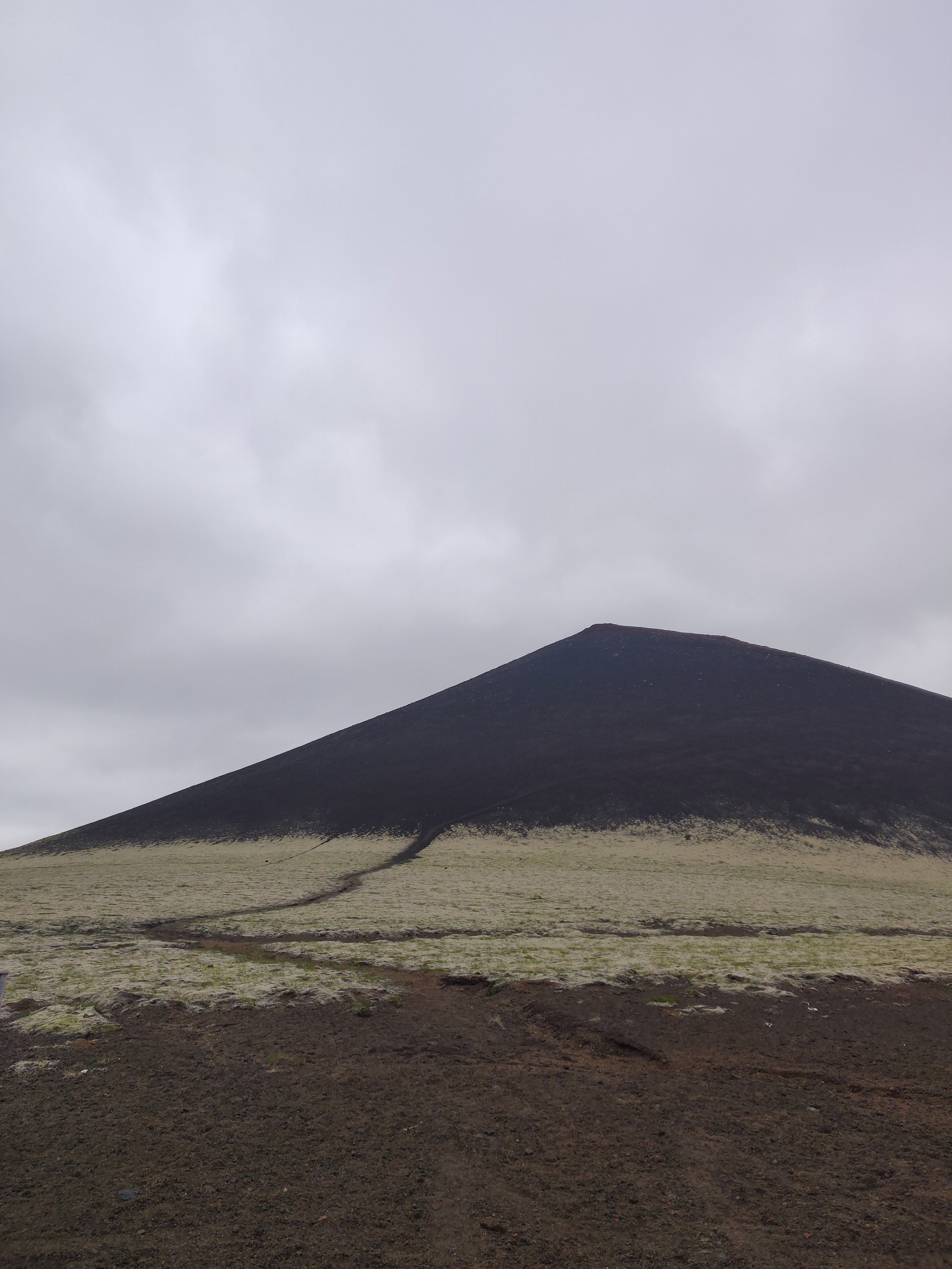
Snæfellsjökull Glacier
Like much of the area, Snæfellsjökull shares the peninsula’s volcanic history. Indeed, this 700,000-year-old glacier-capped volcano sits on the tip of the peninsula and rises 1,446 meters above the sea.
The mountain is actually called ‘Snæfell’ (Snowy Mountain), while ‘jökull’ is the Icelandic word for “glacier”.
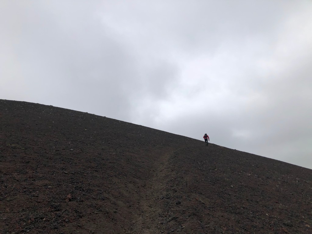
Accessing the glacier is only possible through the F570 road that traverses the peninsula between Ólafsvík in the north and Arnarstapi in the south. This was our first experience driving along an F road in Iceland and it was definitely a challenge.
The steep, rocky, foggy road made it difficult to climb with the full drive taking us over an hour to complete. I would absolutely recommend undertaking this drive with a 4-wheel drive car, even if we came across a couple of brave drivers attempting the climb in a 2-wheel drive.
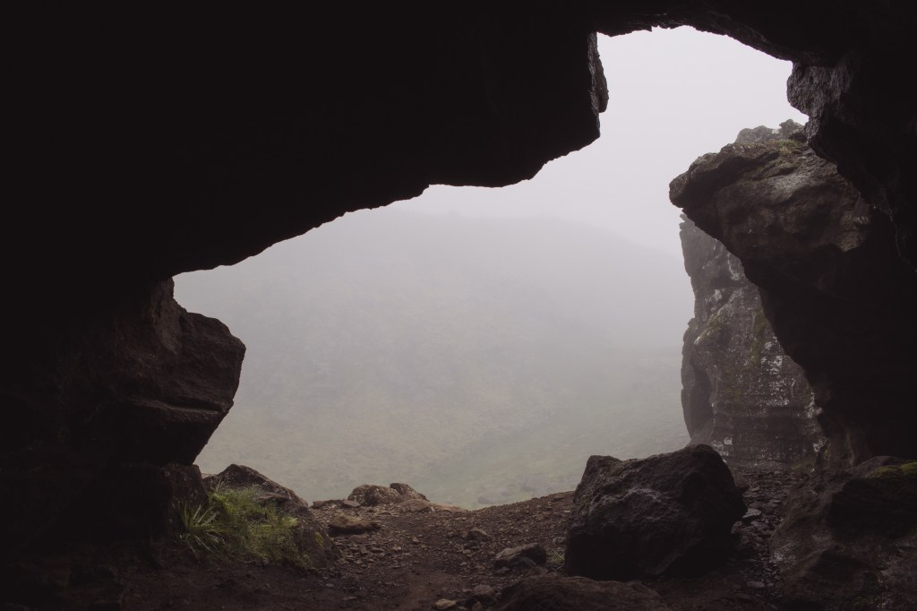
Shortly after you start along route F570 from Arnarstapi, you’ll come across Sönghellir, a small cave that’s a short walk from the main road. The fog didn’t only make our drive difficult, it also lent a very ominous atmosphere as we walked to the cave. The rocks lining the hills around us took the shapes of people, stalking us as we ventured deeper into their realm.
The appearance of people wandering
along the ridge above us, watching us as we approached the cave.
Inside Sönghellir cave
and the fog clouding the nearby hills.
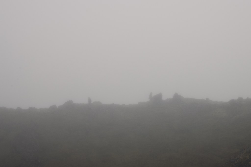
As we progressed along the road over the highest part of the mountain, right next to the glacier, we eventually came out of this somber setting onto a much brighter scene.
If you’re feeling adventurous, there are a number of tour companies with whom you can book a glacier hike, definitely a once in a lifetime experience. You can typically go on these walks from May until September. On a clear, sunny day you’ll be greeted with an absolutely stunning panorama from the top of the glacier, looking down at the wide expanse of Snæfellsnes below you.
Having passed the glacier (without getting a good look at it sadly…) we made our way down towards Ólafsvík from Snæfellsjökull where we were greeted with bright blue skies and snow-covered black mountains.

The drive down was less challenging than the way up, however, you’ll still be faced with a steep, narrow dirt path to descend.
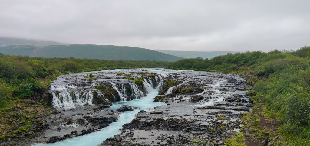
Selvallafoss
This hidden gem in the north of the peninsula, also known as the “Sheep’s Waterfall”, is a short drive after Kirkjufell. Although it’s less well-known than Kirkjufellsfoss, it’s equally beautiful but off the beaten track, so a lot calmer than the more popular spots.
Making your way from the car park to the waterfall, you’ll see an incredible panoramic view unfold before you in the shape of lava fields, extinct vents, and lake Selvallavatn.

One of the best things about Selvallafoss is that you can walk behind it! Indeed, if you follow the trail, you’ll be taken behind the waterfall to admire the water drizzle down from the rock above. Needless to say, you should wear waterproof clothing and walking boots are recommended as the rocks are covered in moss and slippery.
Ölkelduvatn Mineral Spring
Have you dreamt of finding the fountain of youth? A source of water so potent, possessing such incredible healing properties that it lives only in myth.
Now, what if I told you that you could drink from it, right here in the Snaefleness peninsula?
Ok, well…not quite. But the Ölkelduvatn Mineral Spring is supposed to have many therapeutic properties if you don’t mind the heavily carbonated taste of the water.
We came across this quirky little stop as we entered the peninsula on our way up from Reykjavik.
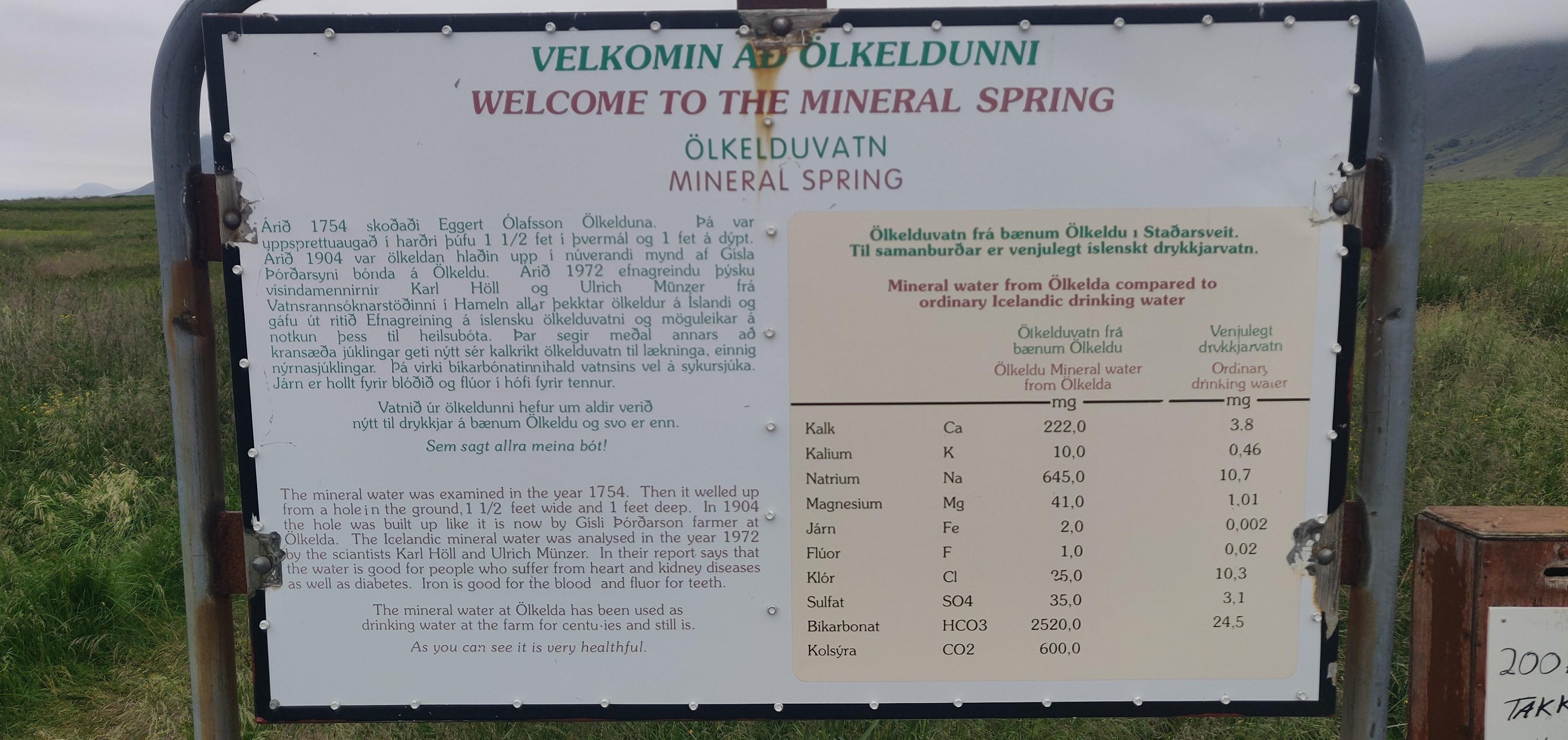
According to the signpost near the spring, the water possesses a much higher concentration of minerals than “ordinary” water, lending it curative properties. I’ll let you experience this for yourself and decide whether you felt any younger, or perhaps even a surge of immortality as you sipped on this rare beverage.